Predicting Weather Through Unconventional Means
September 16, 2013 by Thomas Miller
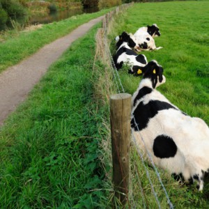
PHOTOS.COM
Cows lying down? Better take cover. Cows tend to group together when poor weather is on the way, and they will typically lie down before a thunderstorm.
A key driver of activity in life is weather. A baseball game, a military mission, the space shuttle launch and school days throughout the country are all things that are impacted both negatively and positively every year by different weather factors. If there were to be a breakdown in communications from an electromagnetic pulse (EMP) or some other catastrophic event that prevented weather forecasts from being disseminated to the general public, weather-prediction skills would be invaluable. So what are some of the things to look for when trying to predict what the weather has in store? Clouds, geographical features, barometric pressure, animal behaviors and folklore can all be reliable guidelines to use to predict the weather in the absence of professional forecasts.
Clouds
Clouds can be a good indicator of what the weather may be doing. If you can learn to identify the different types of clouds, you may be able to accurately predict specific types of weather that may be rolling your way soon.
Low clouds (below 6,500 feet of altitude):
- Cumulus: Meaning heap in Latin, these clouds are typically the easiest to identify and are usually associated with fair weather, but cumulus clouds are known to produce precipitation if they are very tall. If these clouds get bunched and large, that can result in heavy showers, particularly when the weather is warm.
- Stratus: The Latin word for blanket or layer, stratus clouds are low-hanging clouds that are known for covering the entire sky like a blanket. Stratus clouds often produce rain and drizzle. Usually, if they lift quickly in the morning, it indicates that a decent day of weather is ahead.
- Nimbostratus: These clouds are classified by the dark sheets that blot out the sun and are usually followed by extended precipitation (several hours) within a couple of hours.
- Stratocumulus: Clouds that may produce light precipitation but usually dissipate by the end of the day and are identified by the low, rolling mass of thin, lumpy white to gray clouds that may cover the entire sky.
Middle clouds (6,500 to 20,000 feet of altitude):
- Altocumulus: These clouds are patterned, white to gray clouds that often appear in waves or are rippled and are larger than cirrocumulus clouds. Altocumulus clouds are considered to be fair-weather clouds and usually occur after storms.
- Altostratus: Formless gray to bluish clouds, they will form a thin veil over the sun and moon. If they gradually darken and blot out the sun or moon, it is a sign that precipitation is on the way.
High clouds (More than 20,000 feet of altitude):
- Cirrus: Meaning curl in Latin, cirrus clouds reside high in the atmosphere in the very cold air because these clouds are made of ice crystals. Cirrus clouds are usually associated with fair weather but occasionally may also be an indicator that storms may be on their way.
- Cirrocumulus: Clouds that appear in layers that look like either fish scales or rippled sand. Sometimes, cirrocumulus clouds also appear to look like rippled surface water on a pond or lake. These clouds are considered a sign of good weather and often clear out to blue sky.
- Cirrostratus: These clouds are composed of ice particles and form a halo around the sun. When a sky filled with cirrus clouds darkens and the clouds turn to cirrostratus, it is likely a sign of rain or snow to come, depending on the temperature.
Towering clouds (up to 60,000 feet of altitude):
- Swelling cumulus: These flat-bottomed clouds with growing, cauliflower-like towers often form in the middle of the day and precede cumulonimbus clouds.
- Cumulonimbus: Towering storm clouds that produce hail, thunder, strong winds, sleet, rain, lightning and tornadoes. These clouds are usually characterized by a top that is often similar in shape to an anvil. If these clouds form early in the day, it can mean that there are greater chances of severe weather.
Geographical Impact On Weather
The geography of a particular area can influence the weather in the following manners:
- Coastal regions typically have more moderate temperatures than inland regions, meaning that they generally are warmer in the winter and cooler in the summer.
- The air above urban areas is often warmer than in less developed/lower population dense areas. This can sometimes result in an artificial low-pressure system.
- Hilly regions generally have temperature shifts where warm air will move uphill during the day and downhill at night.
Barometric Pressure
Changes in barometric pressure can be determined in a variety of ways, including:
- The nose knows. The strengths of scents often increase or decrease along with changes in barometric pressure. Plants will release their waste products in a low-pressure atmosphere. This generates a compost-like smell, indicating upcoming precipitation. Swamp gasses (marked by their unpleasant smells) are also released just before a storm as a result of low pressure in the atmosphere. The scents of some flowers are also very strong just before a rain.
- The air bubbles in your coffee cup will ring to the outside of your cup when a low-pressure system sets in. This is an indicator that rain is on the way.
- Smoke from a campfire indicates approximate barometric pressure. If the smoke from a campfire hangs low to the ground (an indicator of low barometric pressure), then rain is likely to fall soon. If smoke from a campfire rises high (an indicator of high barometric pressure), then good weather is in the future.
- While there is no scientific reasoning that I could find, it has been shown through various studies that people who suffer from joint and muscle pain can sense (usually through pain) when the barometric pressure is dropping. This is a sign of precipitation.
Animal Behaviors
Animals are a helpful indicator in determining the weather. Consider these points:
- Crickets can help you determine the temperature. Count the number of cricket chirps you hear in 14 seconds and then add 40 to get the temperature in Fahrenheit. For example: 40 chirps + 40 = 80 degrees F. To determine the temperature in Celsius, count the number of chirps in 25 seconds, divide by three, then add four to get the temperature.
- Many animals’ ears are sensitive to low-pressure systems. Wolves and dogs will become nervous before a storm and emit whines or howl-like sounds.
- Seagulls and geese rarely fly just prior to a storm. The thinner air associated with low-pressure systems makes it harder for these birds to get airborne. Seagulls also will not typically fly at the coast if a storm is coming.
- Birds flying high in the sky indicate fair weather (high-pressure system).
- Cows tend to group together when poor weather is on the way, and they will typically lie down before a thunderstorm.
- Ants will steepen the sides of their hills just before it rains.
Folklore
Folklore has been fairly reliable over the years in helping predict the weather. Of course, the time of year can be just as much a factor. It seems unlikely that a cloudless night in July will lead to frost in many areas.
- “Red sky at night, sailor’s delight. Red sky at morning, sailors take warning.” A red sky at night during sunset (when looking toward the west) indicates a high-pressure system with dry air that has stirred dust particles into the air, causing the sky to appear red. Typically, the jet stream and prevailing front movements go from west to east, meaning that the dry weather is headed toward you. A red sky in the morning (in the east with the rising sun) means that the dry air has already moved past you and that a low-pressure system is behind it (moving your way), bringing moisture with it.
- “Short notice, soon to pass. Long notice, long will last.” If clouds take several days to build, extended rain is likely in the cards. If a storm system builds quickly, it is likely to dissipate quickly as well.
- “Clear moon, frost soon.” If the night sky is clear enough to see the moon as a result of no cloud cover, heat will be allowed to escape and the temperature could drop enough for frost to form in the morning.
Other Indicators
There are several other indicators that can assist in determining temperature, precipitation, humidity and inclement weather:
- Lightning strike distance can be estimated by counting the number of seconds between the sight of the lightning and the sound of the thunder and then divide this number by five. This will give you the distance in miles that you are from the lightning strike. To determine the distance in kilometers, the process is the same except you divide the number of seconds by three instead of five.
- Check the grass at sunrise. Dry grass at sunrise indicates clouds and/or strong breezes, which can mean rain. Dew on the grass means that it probably won’t rain that day. (If it rained the night before, this method will not be reliable.)
- Cloud cover on a winter night translates to warmer weather, because the cloud cover prevents heat radiation that would ordinarily occur and lower the temperature on a clear night.
- The low cloud cover that is typically present right before rainfall also results in louder and more vibrant sounds as they are reflected and amplified off of the low clouds.
- Winds blowing from the east indicate an approaching storm front. Winds out of the west generally indicate good weather. Strong winds from any direction indicate a high-pressure difference, which can mean a possible storm front approaching.
- If the sharp points on a half-moon are not clear, rain may be on the way. (Haze and low clouds distort images.)
- Humidity is most often felt when it is high. But indicators of high humidity include frizzy hair, curled leaves on oak and maple trees, swollen wood doors, and salt in the shaker that is clumped together.
There is no substitution for professional meteorological predictions; but in the absence of trained professionals, having the tools to predict the weather can be extremely helpful. This is especially true during survival situations.
No comments:
Post a Comment
Thanks for commenting. Your comments are needed for helping to improve the discussion.